File:Kilima-Map-ChapaaCrossing.png
Jump to navigation
Jump to search


Size of this preview: 628 × 600 pixels. Other resolutions: 251 × 240 pixels | 940 × 898 pixels.
Original file (940 × 898 pixels, file size: 1.31 MB, MIME type: image/png)
Summary
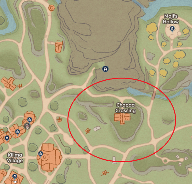
Chapaa Crossing circled on Kilima Valley Map, northeast of Kilima Village.
Licensing
File history
Click on a date/time to view the file as it appeared at that time.
| Date/Time | Thumbnail | Dimensions | User | Comment | |
|---|---|---|---|---|---|
| current | 03:37, 24 May 2024 | | 940 × 898 (1.31 MB) | Reiyu (talk | contribs) | Chapaa Crossing circled on Kilima Valley Map, northeast of Kilima Village. Category: Map Images |
You cannot overwrite this file.
File usage
The following page uses this file: